
Build a location bible for your novel: maps, floor plans, place notes and sensory details that keep every setting consistent and vivid.
The Cartographer's Compendium: Crafting a Definitive Location Bible
In the intricate dance of storytelling, whether for film, television, novels, or even elaborate role-playing games, the stage upon which events unfold is as crucial as the characters who inhabit it. A well-realized setting imbues narratives with authenticity, grounding fantastical elements and lending weight to dramatic stakes. Yet, far too often, the painstaking detail of a location's geography, architecture, and functional dynamics remains an ephemeral concept in the creator's mind, susceptible to inconsistencies and misremembering.
This is where the "Location Bible" emerges not just as a helpful tool, but as an indispensable cornerstone of world-building. More than a simple collection of reference images, it is a living document, a meticulous compendium of maps, floor plans, and detailed descriptions that ensures every corner of a fictional (or even historical) space is precisely defined, consistently portrayed, and readily accessible to all creative collaborators.
The Location Bible isn't merely for the production designer or the art director; it is a shared language for the entire creative team. From the director needing to block a scene to the writer ensuring a character's journey through a building is logical, from the actor understanding their character's spatial limitations to the VFX artist needing accurate spatial data, a robust Location Bible clarifies ambiguities and prevents costly misinterpretations.
It is the ultimate spatial source of truth, eliminating debates about which door leads where, how many steps to the attic, or the exact dimensions of a critical room. This article will delve into the art and science of constructing such a bible, exploring its essential components and the methodologies for its effective creation and maintenance.
In the process of creating a comprehensive Location Bible, it is essential to understand the foundational elements that contribute to a compelling narrative. A related article that delves into this topic is "Understanding Premise: Top 3 Tips for Crafting One," which offers valuable insights into developing a strong premise that can enhance your storytelling. You can read it here: Understanding Premise: Top 3 Tips for Crafting One. This resource complements the concept of mapping out locations by emphasizing the importance of a well-defined premise in shaping the overall structure of your story.
Laying the Foundational Framework: Defining Scope and Scale
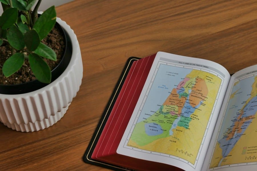
Before a single line is drawn or a photograph cataloged, the first critical step in building a Location Bible is to meticulously define its scope and scale. This initial phase dictates the level of detail required, the types of resources to be gathered, and ultimately, the utility of the finished product. Without a clear understanding of what needs to be documented and why, the project risks becoming an unwieldy collection of disparate information rather than a cohesive, functional guide.
Determining the Geographic Extent
The scope of your Location Bible begins with its geographic boundaries. Is your narrative confined to a single house, a bustling city block, an entire fictional kingdom, or even an interstellar federation? The answer to this question profoundly impacts the type of mapping required. For a story set primarily within a single building, detailed floor plans and architectural elevations will take precedence.
For a saga spanning continents, macro-level world maps, regional layouts, and perhaps even astronomical charts become essential. It's crucial to resist the urge to document everything if it doesn't directly serve the narrative. Over-documentation can lead to bloat and diminish the usability of the bible. Conversely, under-documenting critical areas will inevitably lead to inconsistencies and creative bottlenecks down the line.
A practical approach involves identifying all locations that characters interact with, travel through, or even refer to, and prioritizing their documentation based on their narrative significance.
Establishing the Granularity of Detail
Once the geographic extent is established, the next consideration is the granularity of detail. How "zoomed in" do you need to be? For a clandestine meeting in a dimly lit alley, a simple sketch of the alley's entrance and exit might suffice, alongside notes on its prevailing atmosphere. For a complex heist sequence involving multiple entry points, surveillance blind spots, and intricate interior passages, every single dimension, structural detail, and potential obstacle must be meticulously documented. This often involves a multi-layered approach: a broad overview map of a region, a more detailed street map of a specific town, and then incredibly precise floor plans for key buildings within that town.
Consider the needs of your various collaborators. A writer might need only a general sense of a town's layout to inform character journeys, while a set designer will require precise measurements for every prop and architectural feature within a particular room. The Location Bible must cater to these diverse needs, providing both macro and micro perspectives. This often means including both illustrative, atmospheric maps and highly technical, dimensioned drawings. Deciding on the appropriate level of detail early on will save considerable time and effort, preventing both superficiality and excessive, unnecessary documentation.
The Cartographic Core: Building the Map Collection
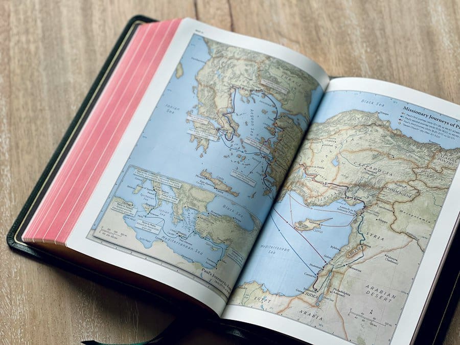
The heart of any Location Bible lies in its maps. These visual representations are the primary tools for understanding spatial relationships, navigation, and the overall lay of the land. From sprawling continents to intimate room layouts, maps provide an invaluable common reference point for all creative endeavors.
World and Regional Maps
For narratives encompassing vast territories, comprehensive world and regional maps are paramount. These are the broad strokes, defining political boundaries, major geographical features (mountains, rivers, oceans), and the placement of significant settlements. These maps can be conceptual – depicting a fantastical realm – or meticulously researched if based on historical or real-world locations. The key here is clarity and legibility. Key locations should be clearly labeled, and geographical features should be represented consistently.
Beyond basic topography, these maps can be enriched with additional layers of information. Historical territories, trade routes, cultural zones, or even prevailing weather patterns can be overlaid or indicated through various graphical conventions. For a novel, these maps might reside in an appendix, guiding the reader through the protagonist's journey. For a film, they serve as a crucial reference for art direction, visual effects, and even narrative consistency, ensuring characters don't magically traverse impossible distances in implausible timeframes. The creation of these maps often begins with hand-drawn sketches, evolving into digital renderings using mapping software or even specialized world-building applications that can simulate geological processes.
City, Town, and Local Area Maps
As the narrative focus narrows, so too must the detail of the maps. City, town, and local area maps provide a much finer grain of information. These maps detail street layouts, the placement of individual buildings, parks, significant landmarks, and infrastructure elements like bridges or subway lines. For a fictional city, this is where its unique character begins to emerge. Are the streets winding and ancient, or grid-like and modern? Are there distinct districts with varying architectural styles or social functions?
These maps are indispensable for plotting character movements, understanding logistical challenges (e.g., getting from the police station to the crime scene), and establishing the urban or rural atmosphere. They can incorporate details such as public transport routes, areas of particular demographic concentrations, or even zones of specific activity (e.g., entertainment districts, industrial zones). Aerial views or isometric projections can be particularly effective here, offering a clear sense of how different structures and areas relate to one another from a bird's-eye perspective. Practical considerations, such as the location of power grids or water sources, might also be included if relevant to the story's mechanics.
Architectural Precision: Floor Plans and Building Layouts
Stepping inside the structures, floor plans become the next indispensable layer of the Location Bible. These technical drawings provide a precise, two-dimensional representation of a building's interior, detailing every room, corridor, and structural element. They are the blueprints that transform abstract spaces into tangible environments.
Detailed Floor Plans for Key Structures
For any building central to the narrative, be it a character's home, a villain's lair, or a historic landmark, detailed floor plans are absolutely essential. These plans should include accurate measurements for rooms, doorways, windows, and structural columns. They clearly delineate internal walls, external walls, and openings. Beyond basic dimensions, floor plans can be augmented with additional details relevant to the story. This might include the placement of key furniture, electrical outlets, plumbing fixtures, or even potential secret passages.
Each floor of a multi-story building should have its own corresponding plan, clearly labeled and cross-referenced. A consistent scale across all floor plans within a single building, and ideally across all buildings in a locale, enhances usability. Color-coding or distinct line weights can be used to differentiate between existing structures, new additions, or areas with specific narrative functions (e.g., "restricted access," "safe zone"). The goal is to provide a comprehensive internal navigation guide, allowing writers to plot character movements with accuracy and designers to visualize sets with precision.
Architectural Elevations and Sections
While floor plans show the horizontal layout, architectural elevations and sections provide critical vertical information. Elevations illustrate the exterior appearance of a building from different perspectives (front, back, sides), detailing window and door placement, rooflines, and decorative elements. These are invaluable for visual consistency, ensuring that exterior shots match internal layouts and that the building's overall aesthetic is cohesive.
Sections, on the other hand, are essentially "cuts" through a building, revealing its internal structure along a vertical plane. They show ceiling heights, multi-level spaces, the relationships between floors, and the placement of internal structural elements like staircases, mezzanines, or elevator shafts. For complex structures, or those with significant vertical components, sections are crucial for understanding spatial volume and flow. They can also highlight hidden features, such as ventilation shafts, crawl spaces, or utility conduits, which might play a role in the narrative (e.g., a character escaping through a vent). Together, floor plans, elevations, and sections provide a complete architectural understanding of any significant location.
In the process of creating a comprehensive Location Bible, understanding the thematic elements that shape your narrative can be incredibly beneficial. An insightful article that delves into this concept is available at the power of theme revealed, which explores how themes influence storytelling and can guide the development of your settings. By integrating thematic considerations into your maps, floor plans, and places, you can create a more cohesive and engaging world for your audience.
Populating the Spaces: Place Descriptions and Annotations
Beyond the purely cartographic and architectural, a truly comprehensive Location Bible breathes life into these spaces through detailed descriptions and annotations. These elements inject character, atmosphere, and functionality, transforming lines and shapes into evocative environments.
Rich Narrative Descriptions
Each significant location, from a grand ballroom to a dingy basement, deserves a rich narrative description. This goes beyond what can be seen on a map or floor plan. What does the place feel like? What are its dominant smells, sounds, or visual textures? Is it brightly lit or perpetually shadowed? What is its history? Who frequents it, and what activities typically occur there? These descriptions are vital for writers to evoke the setting in their prose, for directors to understand the desired mood for a scene, and for actors to ground their performances within the environment.
These descriptions should also include practical details that influence the narrative. Is the furniture heavy or light? Are there multiple exits, or is it a bottleneck? What are the key objects or focal points within the space? For historical or real-world locations, accuracy is paramount, drawing upon historical records, photographs, and firsthand accounts. For fictional locations, the descriptions are an opportunity to deepen the world-building, hinting at the culture, technology, or societal values that shaped the space.
Functional Annotations and Cross-Referencing
To maximize its utility for production, the Location Bible should be heavily annotated with functional information. This might include:
- Key Action Points: Where significant narrative events occur.
- Camera Positions: Suggested camera angles or common shooting points.
- Lighting Considerations: Areas that are naturally bright, dark, or require specific artificial lighting.
- Soundscape Notes: Descriptions of ambient sounds, potential acoustic challenges, or key sound effects.
- Practical Set Requirements: Notes on specific props, set dressing, or practical effects needed for the location.
- Character Interaction Zones: Areas where characters typically interact or congregate.
- Accessibility Notes: Details about ease of access for crew, equipment, or actors with specific needs.
- Security Features: For a secure facility, details about locks, cameras, alarms, or guard posts.
Crucially, the different elements of the Location Bible must be thoroughly cross-referenced. A specific room on a floor plan should link to its detailed description, relevant photographs, and perhaps even historical notes. A point on a regional map might link to a city map, which then links to the floor plans of key buildings within that city. This interconnectedness transforms a mere collection of documents into an intelligent, navigable database. Digital tools, with their hyperlinking capabilities, are particularly adept at facilitating this level of cross-referencing, making it easy for users to jump from a broad overview to the most minute detail with a click.
Maintenance and Accessibility: The Living Document
A Location Bible is not a static artifact to be completed and then filed away. It is a dynamic, living document that must evolve with the project it serves. As narratives develop, as creative decisions shift, and as real-world constraints impose changes, the Location Bible must be updated to reflect these realities.
Version Control and Change Logs
Given its importance as a central source of truth, robust version control is indispensable. Every significant change to a map, floor plan, or description should be logged, detailing what was changed, by whom, and when. This ensures accountability and provides a clear historical record, allowing collaborators to trace the evolution of a location and understand the rationale behind modifications. Digital platforms are ideal for this, often having built-in versioning features.
A "change log" section, easily accessible, should highlight recent updates. This allows team members to quickly review new information without having to pore over the entire document every time. For large, complex projects, a notification system that alerts relevant team members to updates can further enhance efficiency, ensuring everyone is working with the most current information. Without proper version control, inconsistencies can quickly creep in, undermining the very purpose of the Location Bible.
Digital Platforms and Collaborative Tools
While a physical binder might serve for very small, contained projects, the vast majority of modern creative endeavors benefit immensely from a digital Location Bible. Cloud-based platforms, project management software, and specialized world-building applications offer numerous advantages:
- Accessibility: All collaborators, regardless of their physical location, can access the latest version of the bible.
- Searchability: Digital text and tagged images are easily searchable, allowing for quick retrieval of specific information.
- Interactivity: Digital maps can be interactive, allowing users to zoom, pan, and click on areas to reveal further details or linked documents.
- Collaboration: Multiple users can contribute and edit simultaneously (with proper permissions), fostering a collaborative environment.
- Integration: The Location Bible can be integrated with other project management tools, schedules, and asset databases.
Tools like Google Earth Pro, ArcGIS, dedicated world-building software (e.g., World Anvil, Campfire Technology), or even robust document management systems (e.g., Notion, Evernote, Confluence) can be adapted to house and manage a Location Bible. The choice of platform will depend on the project's scale, budget, and the technical proficiency of the team. Regardless of the chosen platform, the emphasis should always be on ease of access, clarity, and the ability for the document to serve as a central, reliable, and up-to-date repository of all spatial information. The Location Bible, meticulously crafted and diligently maintained, becomes the silent architect of narrative coherence, empowering creators to build believable worlds that captivate and resonate.
Want to keep it all in one place? Story Bible Studio gives you a free digital story bible for your characters, places and plot, and Chain Story Online is a free place to test ideas in short collaborative stories.
Related reading: Top Novel Organization Apps: Scrivener Alternatives and Writing Software · Uncovering Continuity Errors and Plot Holes in Novel Consistency
Written by Enda Storrie, writer and creator of Story Bible.


